Showing posts with label Historic Roads. Show all posts

Friday, May 11, 2007

The Old Spanish Trail

The morning begins at 5:30, when I get up to drive Mom to the airport. We've been together for eleven days, through Death Valley, northern Arizona, southern Utah, and now Las Vegas. It's been a great trip. But now she has to return to Iowa, and I must return Susan & Tools' car to them in Oakland.

So now I'm headed west to the Pacific. The first part of this journey, from Las Vegas to Death Valley, will follow an old route called the Old Spanish Trail.

The trail--following ancient paths blazed by Utes, Paiutes and Mojaves--was the primary trade route across the Mojave Desert from the 1820s through the 1850s, extending about 1,200 miles from Santa Fe to Los Angeles.

The Old Spanish Trail was known as "the longest, most arduous and crookedest pack mule route in America"

Back then, trail users included traders, trappers, slavers, horse thieves, military troops and adventurers. Traders took blankets from Santa Fe to California and returned with horses bought and stolen from the west coast. Indian tribes in Utah and Nevada sold their own and other tribal members as slaves in return for European goods.

I picked up the trail heading west on Tropicana Avenue in Las Vegas. Here and there one sees a few references to this historic route.

West Tropicana Avenue in Las Vegas follows the Old Spanish Trail.


On the expanding fringe of Vegas, about 20 miles from the city

Finally, about 20 miles from the fantasy world of the Las Vegas Strip, I put the fastest-growing city in America behind me. Now I'm back in the real world...the Basin & Range, the Mojave Desert.

This was about the only car I saw as I approached the California border.


Downhill from here: Emigrant Pass, 2805 feet above sea level in Inyo County, California
N35.88422 W116.06318

The Lost Forty-Niners passed this way before becoming, well...lost in Death Valley in December 1849. Theirs in an interesting tale of impatience, greed and blunder. Click the link to find out more.

As green as it gets. Near Tecopa, California


At Tecopa I reach Hwy. 127, the north-south road where I take my leave of the Old Spanish Trail. I am about to enter Death Valley National Park, for the second time on this journey.

Next: Bad and Good Water

Friday, April 20, 2007

Utah Highway 95

Looking toward the Henry Mountains along Hwy 95 in southeast Utah

Utah Highway 95 was my single favorite stretch of road on the entire trip. The scenery created by nearby rock formations and faraway mountains was awesome. This is the Colorado Plateau at its finest.

We joined the road about 10 miles north of the Moki Dugway, and followed it in a northwesterly direction all the way to Hanksville, a distance of about 100 miles. In this whole stretch we saw just a handful of cars, and not a single house!

Here are some photos I took along the way...

Sipapu Bridge in White Canyon. See the arch in the center?...that's the bridge.
Natural Bridges National Monument
N37.61395 W110.00367


N37.76080 W110.28361


The Hawa Mahal in Jaipur, India...


...and its Utah cousin?
(OK, I admit the resemblance is not as close as I thought it would be.)


Where Hwy 95 crosses the Colorado River


Finding gas in unusal places. Hanksville, Utah


The place to be in the Beehive State


Next: The Colorado Plateau

Thursday, April 19, 2007

Moki Dugway

Where this was about to take us?

The term "moki" is derived from the Spanish word moqui, which was a general term used by the 18th century Spanish explorers and settlers in the region to describe the Pueblo Indians they encountered.

What is the Moki Dugway? To me, it is an experience, one of performing the impossible.

Actually, it is just a road, or part of one (Hwy 261)...but a very steep (10% grade) and winding road. It was built by a mining company (Texas Zinc) in 1958 to transport uranium ore to Mexican Hat for processing. Three miles of unpaved switchbacks take you 1100 feet up to the top of Cedar Mesa. That's what you see in the distance in the photo below.

Cedar Mesa rises 1,100 feet above the plain.
Unbelievably, we were about to ascend it.
N37.24441 W109.91474

We began the ascent.

After several hundred feet the asphalt pavement disappeared, replaced by dusty gravel. We could never see very far ahead, and several times I thought we were nearing the end, only to be surprised again at the next turn. The views looking down on the tableland below became more and more interesting.


Looking back at where we came from, but still 200 feet from the top

Reaching the top of the mesa (6,418 feet above sea level) the air was cooler and there was much more vegetation. Trees! Our trip was entering a new phase...Welcome to Utah.

N 37.27673 W109.93604

Next: Utah Hwy 95: A Great Scenic Road

Tuesday, April 17, 2007

Monument Valley and the Colossus of Memnon

Mesas became McDonalds...
Hopi blurred to Hampton Inn...
Kachina turned to Kayenta....

This last one is the name of the northeastern Arizona town where we spent the night after taking our leave of the Hopi reservation. Firmly in the grip of American consumerism, Kayenta (from what I saw) could have been any town between Reno and Raleigh. Once my mind submitted to that reality, I was able to enjoy a fine rest and full breakfast at our hotel (a name at the beginning of this post--you guess which one).

We got a late start the next morning, due to a great deal of unpacking and searching for the one indispensable item in our possession: the car key, without which we would be extending our stay here by several days until a spare could be flown in from California. It was a tense situation until the key was found in a grocery sack. Too bad we had already called a towing company to open up the car...

An inconvenient truth: we had no idea where to find the key

When we finally left town, some spectacular scenery greeted us as we drove north on Hwy 163... Monument Valley. The Navajo who live here call this Tsé Bii' Ndzisgaii (I'll let you pronounce it, but it means Valley of the Rocks). Monument Valley is not at all what I consider a valley, but instead a scattering of buttes and mesas rising in splendid isolation hundreds of feet above the floor of the desert.

Every guidebook you look at will tell you that this location has been the backdrop for many a Western, but even such films as 2001: A Space Odyssey, Indiana Jones and the Last Crusade, and Forrest Gump include scenes shot here.


So many formations and angles that it's hard to keep track of them. The top photo is centered on a spot called Mitchell's Butte, and the bottom one is--I believe--looking at Monument Pass.

No wonder this place is an icon. Stare at these rocks long enough, and the mind will start to see things and make associations. Some of the names on the map include words like Stagecoach, Saddleback, Elephant... One rock I saw reminded me of a place I had visited in Egypt several years ago. Don't tell me that you can't see a resemblance:

This spot in Monument Valley...
N36.81959 W110.24969

...reminds me of this 3,400-year-old statue near Luxor, Egypt.
N25.72055 E32.61055

The map calls this Owl's Rock, but I'm calling it
The Colossus of Memnon
. You heard it here first.

Next: Goosenecks of the San Juan

Tuesday, March 27, 2007

Route 66

Flagstaff was on the path of old US Route 66, and the town has gone to some efforts to preserve its memory.

Route 66 began as a way to link main streets of rural and urban communities that had no access to national highways, allowing farmers on the prairies and plains to get grain and other crops to major markets. Its diagonal path from Chicago to Los Angeles is fairly flat and temperate, making it popular and practical for truck shipping. During the Dustbowl of the 1930s, Route 66 was a major route for migrants heading west to California. In the 1950s it was the main highway for vacationers to Los Angeles.

When Route 66 received its numerical designation in 1926 it was the first interstate highway. The entire 2,448-mile length of Route 66 was not paved until 1938. US66 was officially decommissioned in 1985, after it was deemed irrelevant due to the Interstate Highway System. This has crippled many small towns that were economically dependent on the highway.


Old Route 66 in Flagstaff: 1950 and Today. Grew from two lanes to five, but seems the weather hasn't changed. (N35.19012 W111.66433)

Sunday, March 25, 2007

Borax and the Twenty Mule Teams


Of all the minerals mined in Death Valley over the years, borax produced the most profits, and became known as the White Gold of the desert. Borates are salt minerals. They were deposited in ancient lake beds that were uplifted and eroded. Water dissolved the borates and carried them to the Death Valley floor, where they recrystallized as borax. Borax is used in fiberglass, welding flux, insecticides and fungicides, corrugated cardboard, soap and detergents, and fire retardant.

In 1881 borax was found near Furnace Creek. Rights to the claim (and the nearby water, necessary for processing) were sold to William Tell Coleman, who built the Harmony borax works in 1883. Borax was mined at this site until 1888. Chinese workmen gathered the ore.

Site of the Harmony borax works in Death Valley
(N36.47977 W116.87553)

Extracting and processing the borax was a relatively straightforward operation, and the thorniest issue the mining company faced was how to get its product to market. The answer was supplied by the twenty mule team--whose image lives on in Western lore despite being in use only six years (1883-1889)--to haul the ore 165 miles to the railhead in Mojave, California. Its fame is due primarily to a successful advertising campaign which promoted 20-Mule-Team Borax Soap and a long-running radio and television program, “Death Valley Days.”

The twenty mule teams could pull loads weighing up to 36 tons, including 1,200 gallons of drinking water. The entire unit with mules was more than 100 feet long.
In 1884 a steam tractor replaced the twenty mule teams, and this in turn was replaced by the Borate and Daggett railroad. Salt marsh operations such as those at Harmony were obsolete by 1890. The underground Billie Mine, which closed in 2005, was the last borax mining operation in the Death Valley area.

Left: One of the original wagons and water tank for the twenty mule teams. Right: Steam tractor introduced in 1894 to replace the twenty mule teams. It was in turn replaced by the Borate and Daggett Railroad.

Saturday, March 24, 2007

The Mojave Road

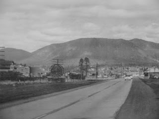
The Mojave Road southeast of Baker, California

The Mojave Road is an ancient trading trail which crosses the Mojave Desert and bisects the Mojave National Preserve from east to west. In former times it connected the villages of the Mojave Indians along the Colorado River with the tribes of the California coast. The Mojave were an agricultural people who were blessed with an abundance of crops, giving them great freedom to travel.

In 1776 a Spaniard, Friar Francisco Garces, became the first European to mingle with the Mojave and utilize their network of desert trails. The Mojave Indians guided him from the Colorado River to the mission of San Gabriel.

Garces wrote about his 1776 journey and produced this map.


Following the natural contours of the land, the Mojave Road was the preferred means of transportation through the area until the coming of the Union Pacific railroad in 1890. The road is popular today as a 4 x 4 route.


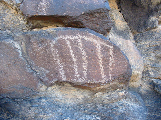
Indian petroglyphs near the Mojave Road
N35.20525 W115.87189